Geolocate

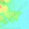
Marlin topographic map

Click on the map to display elevation.

About this map

Name: Marlin topographic map, elevation, terrain.

Location: Marlin, Falls County, Texas, 76661, United States (31.28369 -96.91646 31.32849 -96.87439)

Average elevation: 119 m

Minimum elevation: 99 m

Maximum elevation: 142 m

Other topographic maps

Click on a map to view its topography, its elevation and its terrain.
Satin

United States > Texas > Falls County

Average elevation: 115 m

Wilderville

United States > Texas > Falls County

Average elevation: 127 m

Bone Branch

United States > Texas > Falls County

Average elevation: 147 m

Gear up for your next adventure:

🦺Outdoor Safety Vests - Increase visibility and safety
🧿Outdoor Gadgets - Innovative tools for outdoor enthusiasts
💡Hiking Headlamps - Hands‑free lights for night hikes
🎒Hiking Backpacks - Durable backpacks for day hikes and multi‑day treks
🧭Sighting Compasses - Professional grade mirror compass for precise orientation

As an Amazon Associate, this site earns from qualifying purchases at no extra cost to you.