
Thank you for supporting this site ❤️
Make a donation
Make a donation
Gear up for your next adventure:
As an Amazon Associate, this site earns from qualifying purchases at no extra cost to you.
Ammerbuch topographic map
Click on the map to display elevation.
Thank you for supporting this site ❤️
Make a donation
Make a donation
Gear up for your next adventure:
As an Amazon Associate, this site earns from qualifying purchases at no extra cost to you.
About this map
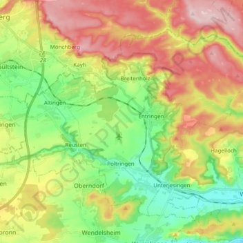
Name: Ammerbuch topographic map, elevation, terrain.
Location: Ammerbuch, Landkreis Tübingen, Baden-Württemberg, 72119, Germany (48.51394 8.88376 48.59132 9.03419)
Average elevation: 438 m
Minimum elevation: 326 m
Maximum elevation: 583 m
Thank you for supporting this site ❤️
Make a donation
Make a donation
Gear up for your next adventure:
As an Amazon Associate, this site earns from qualifying purchases at no extra cost to you.