
Lawlor's Strand topographic map
Interactive map
Click on the map to display elevation.
About this map
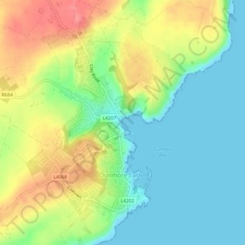
Name: Lawlor's Strand topographic map, elevation, terrain.
Location: Lawlor's Strand, Dunmore East, Ireland (52.15401 -6.99471 52.15526 -6.99356)
Average elevation: 33 m
Minimum elevation: 0 m
Maximum elevation: 84 m
Ireland trails, hiking, mountain biking, running and outdoor activities