
Thank you for supporting this site ❤️
Make a donation
Make a donation
Gear up for your next adventure:
As an Amazon Associate, this site earns from qualifying purchases at no extra cost to you.
Groesbeek topographic map
Click on the map to display elevation.
Thank you for supporting this site ❤️
Make a donation
Make a donation
Gear up for your next adventure:
As an Amazon Associate, this site earns from qualifying purchases at no extra cost to you.
About this map
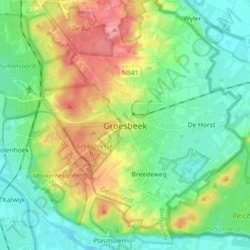
Name: Groesbeek topographic map, elevation, terrain.
Location: Groesbeek, Gelderland, Nederland, 6562ZR, Nederland (51.73418 5.89065 51.81418 5.97065)
Average elevation: 36 m
Minimum elevation: 6 m
Maximum elevation: 94 m
Thank you for supporting this site ❤️
Make a donation
Make a donation
Gear up for your next adventure:
As an Amazon Associate, this site earns from qualifying purchases at no extra cost to you.