Geolocate

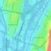
West View topographic map

Click on the map to display elevation.

About this map

Name: West View topographic map, elevation, terrain.

Location: West View, Ridgefield Park, Bergen County, New Jersey, 07603, United States (40.84510 -74.04764 40.88510 -74.00764)

Average elevation: 12 m

Minimum elevation: -4 m

Maximum elevation: 52 m

Other topographic maps

Click on a map to view its topography, its elevation and its terrain.
Gear up for your next adventure:

🧊Hydration Reservoirs - Easy drinking on the move with 2L or 3L bladders
🛌3-Season Sleeping Bags - Comfortable insulation for Irish spring and autumn nights
🔦Everyday Carry Torches - Reliable backup light for your hiking pack
📱Phone Holders for Biking - Secure phone mounts for touring cyclists
🔗Locking Carabiners - Secure gear to your pack or for light climbing

As an Amazon Associate, this site earns from qualifying purchases at no extra cost to you.