Geolocate

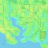
Pretty Bayou topographic map

Click on the map to display elevation.

About this map

Name: Pretty Bayou topographic map, elevation, terrain.

Location: Pretty Bayou, Panama City, Bay County, Florida, United States (30.19260 -85.67799 30.19478 -85.67590)

Average elevation: 10 m

Minimum elevation: 3 m

Maximum elevation: 15 m

Other topographic maps

Click on a map to view its topography, its elevation and its terrain.
Millville

United States > Florida > Bay County > Panama City

Average elevation: 9 m

Millville

United States > Florida > Bay County > Panama City

Average elevation: 9 m

Gear up for your next adventure:

🔌Fast Car Chargers - Recharge GPS and phones between trailheads
🧯Compact Fire Extinguishers - Safety for campervans and expedition vehicles
📚Irish Walking Guides - The best mapped trails in Wicklow, Kerry, and Connemara
⛺Ultralight Hiking Tents - Compact shelters for multi-day wild camping in Ireland
🛸Lightweight Camera Drones - Capture stunning aerial topographic views of the landscape

As an Amazon Associate, this site earns from qualifying purchases at no extra cost to you.