Geolocate

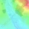
Kvemo Rene topographic map

Click on the map to display elevation.

About this map

Name: Kvemo Rene topographic map, elevation, terrain.

Location: Kvemo Rene, Kaspi Municipality, Shida Kartli, 2600, Georgia (41.98250 44.33145 42.02250 44.37145)

Average elevation: 812 m

Minimum elevation: 691 m

Maximum elevation: 1,065 m

Other topographic maps

Click on a map to view its topography, its elevation and its terrain.

Kaspi

Georgia > Shida Kartli > Kaspi Municipality

Average elevation: 580 m

Kvemo Chala

Georgia > Shida Kartli > Kaspi Municipality

Average elevation: 781 m

Gear up for your next adventure:

🪓Camping Axes & Hatchets - Wood cutting tools for campsite prep
🛡️Protective Bike Gear - Helmets & pads for safe rides
🔥Compact Camping Stoves - Fast-boil stoves for trail-side meals and coffee
🧥Waterproof Hiking Jackets - Rain jackets for unpredictable weather
🧺Quick-Dry Hiking Towels - Space-saving towels for wild swimming or camping

As an Amazon Associate, this site earns from qualifying purchases at no extra cost to you.