
Thank you for supporting this site ❤️
Make a donation
Make a donation
Gear up for your next adventure:
As an Amazon Associate, this site earns from qualifying purchases at no extra cost to you.
Dietenhofen topographic map
Click on the map to display elevation.
Thank you for supporting this site ❤️
Make a donation
Make a donation
Gear up for your next adventure:
As an Amazon Associate, this site earns from qualifying purchases at no extra cost to you.
About this map
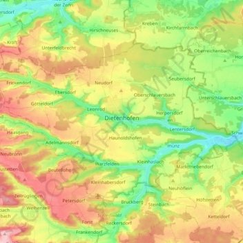
Name: Dietenhofen topographic map, elevation, terrain.
Location: Dietenhofen, Ansbach (district), Bavaria, 90599, Germany (49.35939 10.59306 49.43723 10.77623)
Average elevation: 394 m
Minimum elevation: 321 m
Maximum elevation: 483 m
Thank you for supporting this site ❤️
Make a donation
Make a donation
Gear up for your next adventure:
As an Amazon Associate, this site earns from qualifying purchases at no extra cost to you.