
Thank you for supporting this site ❤️
Make a donation
Make a donation
Gear up for your next adventure:
As an Amazon Associate, this site earns from qualifying purchases at no extra cost to you.
Cascajo topographic map
Click on the map to display elevation.
Thank you for supporting this site ❤️
Make a donation
Make a donation
Gear up for your next adventure:
As an Amazon Associate, this site earns from qualifying purchases at no extra cost to you.
About this map
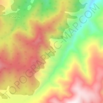
Name: Cascajo topographic map, elevation, terrain.
Location: Cascajo, Santiago, Putumayo, RAP Amazonía, Colombia (1.06027 -77.06097 1.10027 -77.02097)
Average elevation: 2,811 m
Minimum elevation: 2,371 m
Maximum elevation: 3,172 m
Thank you for supporting this site ❤️
Make a donation
Make a donation
Gear up for your next adventure:
As an Amazon Associate, this site earns from qualifying purchases at no extra cost to you.