
Thank you for supporting this site ❤️
Make a donation
Make a donation
Gear up for your next adventure:
As an Amazon Associate, this site earns from qualifying purchases at no extra cost to you.
Sarmar topographic map
Click on the map to display elevation.
Thank you for supporting this site ❤️
Make a donation
Make a donation
Gear up for your next adventure:
As an Amazon Associate, this site earns from qualifying purchases at no extra cost to you.
About this map
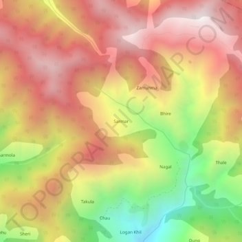
Name: Sarmar topographic map, elevation, terrain.
Location: Sarmar, Ramban, Ramban District, Jammu and Kashmir, India (33.25642 75.28056 33.29642 75.32056)
Average elevation: 2,338 m
Minimum elevation: 1,542 m
Maximum elevation: 2,922 m
Thank you for supporting this site ❤️
Make a donation
Make a donation
Gear up for your next adventure:
As an Amazon Associate, this site earns from qualifying purchases at no extra cost to you.