
Municipal District of Macroom topographic map
Interactive map
Click on the map to display elevation.
About this map
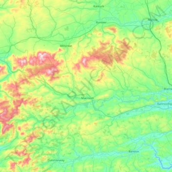
Name: Municipal District of Macroom topographic map, elevation, terrain.
Location: Municipal District of Macroom, County Cork, Munster, Ireland (51.78492 -9.35959 52.09688 -8.53120)
Average elevation: 169 m
Minimum elevation: 0 m
Maximum elevation: 677 m
County Cork trails, hiking, mountain biking, running and outdoor activities
Other topographic maps
Click on a map to view its topography, its elevation and its terrain.