
Thank you for supporting this site ❤️
Make a donation
Make a donation
Gear up for your next adventure:
As an Amazon Associate, this site earns from qualifying purchases at no extra cost to you.
Kuşluhan topographic map
Click on the map to display elevation.
Thank you for supporting this site ❤️
Make a donation
Make a donation
Gear up for your next adventure:
As an Amazon Associate, this site earns from qualifying purchases at no extra cost to you.
About this map
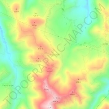
Name: Kuşluhan topographic map, elevation, terrain.
Location: Kuşluhan, Bulancak, Giresun, Black Sea Region, Turkey (40.85922 38.22254 40.89922 38.26254)
Average elevation: 386 m
Minimum elevation: 138 m
Maximum elevation: 691 m
Thank you for supporting this site ❤️
Make a donation
Make a donation
Gear up for your next adventure:
As an Amazon Associate, this site earns from qualifying purchases at no extra cost to you.