
Thank you for supporting this site ❤️
Make a donation
Make a donation
Gear up for your next adventure:
As an Amazon Associate, this site earns from qualifying purchases at no extra cost to you.
Silvaplana topographic map
Click on the map to display elevation.
Thank you for supporting this site ❤️
Make a donation
Make a donation
Gear up for your next adventure:
As an Amazon Associate, this site earns from qualifying purchases at no extra cost to you.
About this map
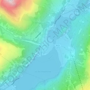
Name: Silvaplana topographic map, elevation, terrain.
Location: Silvaplana, Maloja, Grisons, 7513, Switzerland (46.43993 9.77592 46.47993 9.81592)
Average elevation: 2,027 m
Minimum elevation: 1,786 m
Maximum elevation: 3,006 m
Thank you for supporting this site ❤️
Make a donation
Make a donation
Gear up for your next adventure:
As an Amazon Associate, this site earns from qualifying purchases at no extra cost to you.