
Langar topographic map
Click on the map to display elevation.
About this map
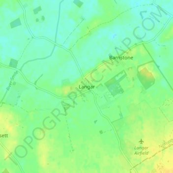
Name: Langar topographic map, elevation, terrain.
Average elevation: 32 m
Minimum elevation: 23 m
Maximum elevation: 43 m
Other topographic maps
Click on a map to view its topography, its elevation and its terrain.
Barton in Fabis
United Kingdom > England > Nottinghamshire > Rushcliffe > Barton-in-Fabis
Average elevation: 39 m
Normanton on the Wolds
United Kingdom > England > Nottinghamshire > Rushcliffe
Average elevation: 59 m
Willoughby on the Wolds
United Kingdom > England > Nottinghamshire > Rushcliffe
Average elevation: 92 m
Archers Lake
United Kingdom > England > Nottinghamshire > Rushcliffe > Bingham
Average elevation: 28 m
Elton-on-the-Hill
United Kingdom > England > Nottinghamshire > Rushcliffe
Elton lies about 14 miles (23 km) east of Nottingham. It straddles the A52 trunk road, from which Station Road runs north towards Orston and Sutton Lane south, with Sutton-cum-Granby being the nearest hamlet in that direction. Elton has a population of 114 people and is in the Rushcliffe district. It has an…
Average elevation: 29 m
Clipston
United Kingdom > England > Nottinghamshire > Rushcliffe
Clipston stands on the northernmost edge of the Wolds in Nottinghamshire. The area enjoys, from an elevation of about 79 m/259 ft, panoramic views of the Trent valley and the East and South side of the city of Nottingham, some 50 m/164 ft lower. Nearby to the west is Hoe Hill, with a horseshoe-shaped wood.
Average elevation: 59 m
Colston Bassett
United Kingdom > England > Nottinghamshire > Rushcliffe > Colston Bassett
Average elevation: 39 m