
Isla del Caño topographic map
Interactive map
Click on the map to display elevation.
About this map
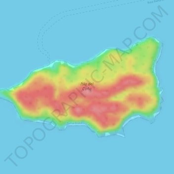
Name: Isla del Caño topographic map, elevation, terrain.
Average elevation: 22 m
Minimum elevation: 0 m
Maximum elevation: 104 m
Other topographic maps
Click on a map to view its topography, its elevation and its terrain.
Bahía Drake
Costa Rica > Provincia Puntarenas > Bahía Drake
Bahía Drake, Cantón Osa, Provincia Puntarenas, 60506, Costa Rica
Average elevation: 76 m