
Morrill County topographic map
Interactive map
Click on the map to display elevation.
About this map
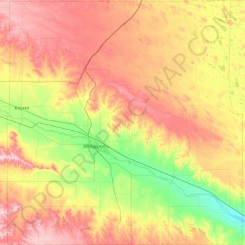
Name: Morrill County topographic map, elevation, terrain.
Location: Morrill County, Nebraska, United States (41.43604 -103.37089 42.00514 -102.63641)
Average elevation: 1,220 m
Minimum elevation: 1,062 m
Maximum elevation: 1,417 m
Other topographic maps
Click on a map to view its topography, its elevation and its terrain.
Lincoln
United States > Nebraska > Lancaster County
Lincoln, Lancaster County, Nebraska, United States
Average elevation: 379 m