
Thank you for supporting this site ❤️
Make a donation
Make a donation
Gear up for your next adventure:
As an Amazon Associate, this site earns from qualifying purchases at no extra cost to you.
Al-Hasakah District topographic map
Click on the map to display elevation.
Thank you for supporting this site ❤️
Make a donation
Make a donation
Gear up for your next adventure:
As an Amazon Associate, this site earns from qualifying purchases at no extra cost to you.
About this map
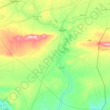
Name: Al-Hasakah District topographic map, elevation, terrain.
Location: Al-Hasakah District, Al-Hasaka Governorate, Syria (35.55309 40.00291 36.85724 41.38651)
Average elevation: 356 m
Minimum elevation: 201 m
Maximum elevation: 914 m
Thank you for supporting this site ❤️
Make a donation
Make a donation
Gear up for your next adventure:
As an Amazon Associate, this site earns from qualifying purchases at no extra cost to you.