
Bull Hill topographic map
Interactive map
Click on the map to display elevation.
About this map
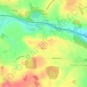
Name: Bull Hill topographic map, elevation, terrain.
Average elevation: 111 m
Minimum elevation: 75 m
Maximum elevation: 145 m
Other topographic maps
Click on a map to view its topography, its elevation and its terrain.
Wickersley
United Kingdom > England > Rotherham > Bramley
Wickersley, Bramley, Rotherham, South Yorkshire Mayoral Combined Authority, England, United Kingdom
Average elevation: 116 m
Maltby
United Kingdom > England > Rotherham
Maltby, Rotherham, Yorkshire and the Humber, England, United Kingdom
Average elevation: 76 m