
Thank you for supporting this site ❤️
Make a donation
Make a donation
Gear up for your next adventure:
As an Amazon Associate, this site earns from qualifying purchases at no extra cost to you.
Elizabethtown topographic map
Click on the map to display elevation.
Thank you for supporting this site ❤️
Make a donation
Make a donation
Gear up for your next adventure:
As an Amazon Associate, this site earns from qualifying purchases at no extra cost to you.
About this map
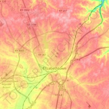
Name: Elizabethtown topographic map, elevation, terrain.
Location: Elizabethtown, Hardin County, Kentucky, 42701, United States (37.64993 -85.94766 37.76760 -85.82020)
Average elevation: 241 m
Minimum elevation: 151 m
Maximum elevation: 283 m
Thank you for supporting this site ❤️
Make a donation
Make a donation
Gear up for your next adventure:
As an Amazon Associate, this site earns from qualifying purchases at no extra cost to you.