Geolocate

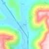
Whitwell topographic map

Click on the map to display elevation.

About this map

Name: Whitwell topographic map, elevation, terrain.

Location: Whitwell, Marion County, East Tennessee, Tennessee, 37397, United States (35.16307 -85.53624 35.22047 -85.49740)

Average elevation: 282 m

Minimum elevation: 187 m

Maximum elevation: 665 m

Other topographic maps

Click on a map to view its topography, its elevation and its terrain.

Sequatchie

United States > Tennessee > Marion County

Average elevation: 260 m

Deadman Eddy

United States > Tennessee > Marion County

Average elevation: 355 m

Haletown

United States > Tennessee > Marion County > Ladds

Average elevation: 286 m

Whiteside

United States > Tennessee > Marion County

Average elevation: 368 m

Shake Rag

United States > Tennessee > Marion County

Average elevation: 343 m

Ladds

United States > Tennessee > Marion County

Average elevation: 291 m

Haletown

United States > Tennessee > Marion County

Average elevation: 286 m

Pinhook

United States > Tennessee > Marion County

Average elevation: 304 m

Gear up for your next adventure:

🔌Travel Adapters - Essential for visitors to charge gear in Ireland
🧿Outdoor Gadgets - Innovative tools for outdoor enthusiasts
🖊️All-Weather Pens - Pressurized ink cartridges that write upside down and in wet
🛌3-Season Sleeping Bags - Comfortable insulation for Irish spring and autumn nights
🍖Freeze-Dried Trail Meals - Nutritious and lightweight food for expeditions

As an Amazon Associate, this site earns from qualifying purchases at no extra cost to you.