Geolocate

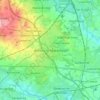
Shevington topographic map

Click on the map to display elevation.

About this map

Name: Shevington topographic map, elevation, terrain.

Location: Shevington, Gathurst, Wigan, Greater Manchester, England, United Kingdom (53.55838 -2.71922 53.59614 -2.67460)

Average elevation: 70 m

Minimum elevation: 16 m

Maximum elevation: 124 m

Other topographic maps

Click on a map to view its topography, its elevation and its terrain.

Aspull

United Kingdom > England > Wigan

Average elevation: 111 m

Leigh

United Kingdom > England > Wigan

Average elevation: 34 m

Shevington Moor

United Kingdom > England > Wigan > Shevington

Average elevation: 88 m

Low Green

United Kingdom > England > Wigan

Average elevation: 40 m

Pennington Green

United Kingdom > England > Wigan > Aspull

Average elevation: 92 m

Wigan

United Kingdom > England > Wigan

Average elevation: 66 m

Astley

United Kingdom > England > Wigan

Average elevation: 44 m

Wigan

United Kingdom > England > Wigan

Average elevation: 66 m

Wigan

United Kingdom > England > Wigan

Average elevation: 66 m

Wigan

United Kingdom > England > Wigan

Average elevation: 66 m

Ashton-in-Makerfield

United Kingdom > England > Wigan

Average elevation: 51 m

Leigh

United Kingdom > England > Wigan

Average elevation: 34 m

Gear up for your next adventure:

🛌3-Season Sleeping Bags - Comfortable insulation for Irish spring and autumn nights
🖊️All-Weather Pens - Pressurized ink cartridges that write upside down and in wet
🧉Camping Coffee Gear - Enjoy coffee outdoors
💡Hiking Headlamps - Hands‑free lights for night hikes
🧺Collapsible Camp Bowls - Save space in your expedition kit

As an Amazon Associate, this site earns from qualifying purchases at no extra cost to you.