
Benespera topographic map
Interactive map
Click on the map to display elevation.
About this map
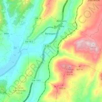
Name: Benespera topographic map, elevation, terrain.
Location: Benespera, Guarda, Portugal (40.40806 -7.29451 40.45165 -7.21309)
Average elevation: 666 m
Minimum elevation: 486 m
Maximum elevation: 971 m
Other topographic maps
Click on a map to view its topography, its elevation and its terrain.