Geolocate

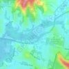
North Avoca topographic map

Click on the map to display elevation.

About this map

Name: North Avoca topographic map, elevation, terrain.

Location: North Avoca, Gosford, New South Wales, Australia (-33.46387 151.42612 -33.44830 151.44614)

Average elevation: 22 m

Minimum elevation: -2 m

Maximum elevation: 82 m

Other topographic maps

Click on a map to view its topography, its elevation and its terrain.
Mount Elliot

Australia > New South Wales > Gosford

Average elevation: 92 m

Mount White

Australia > New South Wales > Gosford

Average elevation: 139 m

Wyong River

Australia > New South Wales > Gosford

Average elevation: 175 m

Wamberal Beach

Australia > New South Wales > Gosford

Average elevation: 7 m

Erina Creek

Australia > New South Wales > Gosford

Average elevation: 23 m

Gear up for your next adventure:

🌂Windproof Trekking Umbrellas - Protection during vertical Irish rain
💧Portable Water Filters - Safe drinking water from streams and lakes
🥾Men's Waterproof Boots - Sturdy footwear for wet and boggy Irish terrain
🔋Portable Power Banks - Keep devices charged on long trips
💺Camping Hammocks - Relax afloat camp setup

As an Amazon Associate, this site earns from qualifying purchases at no extra cost to you.