
Ruppertsgrün topographic map
Interactive map
Click on the map to display elevation.
About this map
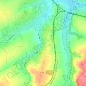
Name: Ruppertsgrün topographic map, elevation, terrain.
Location: Ruppertsgrün, Fraureuth, Zwickau, Sachsen, Deutschland (50.68760 12.35738 50.71461 12.38917)
Average elevation: 317 m
Minimum elevation: 286 m
Maximum elevation: 360 m