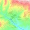
Tbisi topographic map
Click on the map to display elevation.
About this map

Name: Tbisi topographic map, elevation, terrain.
Location: Tbisi, Tetritskaro Municipality, Lower Kartli, Georgia (41.59032 44.53822 41.59199 44.54183)
Average elevation: 833 m
Minimum elevation: 689 m
Maximum elevation: 1,088 m
Other topographic maps
Click on a map to view its topography, its elevation and its terrain.


Algeti National Park
Georgia > Lower Kartli > Tetritskaro Municipality > Jvriskhevi
Average elevation: 1,501 m


Birtvisi Natural Monument
Georgia > Lower Kartli > Tetritskaro Municipality > Tbisi
Birtvisi Natural Monument (Georgian: ბირთვისის ბუნების ძეგლი) is an IUCN Category III protected rocky massif in Tetritsqaro Municipality, in the Kvemo Kartli region of Georgia. It is situated on the southern slopes of the Trialeti Range, near the villages of Tbisi and…
Average elevation: 987 m