
Thank you for supporting this site ❤️
Make a donation
Make a donation
Gear up for your next adventure:
As an Amazon Associate, this site earns from qualifying purchases at no extra cost to you.
Paccayani topographic map
Click on the map to display elevation.
Thank you for supporting this site ❤️
Make a donation
Make a donation
Gear up for your next adventure:
As an Amazon Associate, this site earns from qualifying purchases at no extra cost to you.
About this map
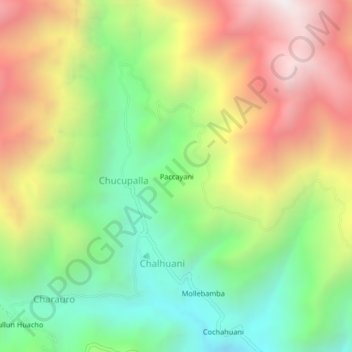
Name: Paccayani topographic map, elevation, terrain.
Location: Paccayani, Chucupalla, Pichirhua, Abancay, Apurímac, Perú (-13.83364 -73.06089 -13.79364 -73.02089)
Average elevation: 3,154 m
Minimum elevation: 2,454 m
Maximum elevation: 4,051 m
Thank you for supporting this site ❤️
Make a donation
Make a donation
Gear up for your next adventure:
As an Amazon Associate, this site earns from qualifying purchases at no extra cost to you.