
Thank you for supporting this site ❤️
Make a donation
Make a donation
Gear up for your next adventure:
As an Amazon Associate, this site earns from qualifying purchases at no extra cost to you.
Pauri topographic map
Click on the map to display elevation.
Thank you for supporting this site ❤️
Make a donation
Make a donation
Gear up for your next adventure:
As an Amazon Associate, this site earns from qualifying purchases at no extra cost to you.
About this map
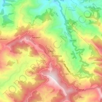
Name: Pauri topographic map, elevation, terrain.
Location: Pauri, Pauri Garhwal, Uttarakhand, 246001, India (30.10799 78.73595 30.18799 78.81595)
Average elevation: 1,423 m
Minimum elevation: 755 m
Maximum elevation: 2,122 m
Thank you for supporting this site ❤️
Make a donation
Make a donation
Gear up for your next adventure:
As an Amazon Associate, this site earns from qualifying purchases at no extra cost to you.