
Make a donation
Gear up for your next adventure:
As an Amazon Associate, this site earns from qualifying purchases at no extra cost to you.
Rocky Mountains topographic map
Click on the map to display elevation.
Make a donation
Gear up for your next adventure:
As an Amazon Associate, this site earns from qualifying purchases at no extra cost to you.
Rocky Mountains
Most of the highest summits of the Rocky Mountains are in Colorado, with that state having an average elevation in excess of 2,000 metres (6,600 ft). Public parks and forest lands protect much of the mountain range, and they are popular tourist destinations, especially for hiking, camping, mountaineering, fishing, hunting, mountain biking, snowmobiling, skiing, and snowboarding.
Make a donation
Gear up for your next adventure:
As an Amazon Associate, this site earns from qualifying purchases at no extra cost to you.
About this map
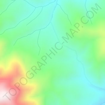
Name: Rocky Mountains topographic map, elevation, terrain.
Location: Rocky Mountains, Teton County, Wyoming, United States (43.35780 -110.91756 43.35790 -110.91746)
Average elevation: 2,292 m
Minimum elevation: 2,090 m
Maximum elevation: 2,769 m
Make a donation
Gear up for your next adventure:
As an Amazon Associate, this site earns from qualifying purchases at no extra cost to you.