Geolocate

Oxted topographic map

Click on the map to display elevation.

About this map
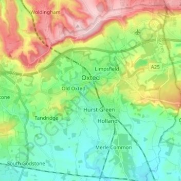
Name: Oxted topographic map, elevation, terrain.

Location: Oxted, Limpsfield, Tandridge, Surrey, England, United Kingdom (51.21233 -0.03626 51.28976 0.01667)

Average elevation: 128 m

Minimum elevation: 54 m

Maximum elevation: 271 m

Gear up for your next adventure:

🌦️Weatherproof Outdoor Gear - Protection from unpredictable weather
🧗Rock Climbing Gear - Essentials for the cliffs of Moher or Gap of Dunloe
🛍️Outdoor Accessory Kits - Bundles for new hikers
📱Phone Holders for Biking - Secure phone mounts for touring cyclists
💡Hiking Headlamps - Hands‑free lights for night hikes

As an Amazon Associate, this site earns from qualifying purchases at no extra cost to you.