
Thank you for supporting this site ❤️
Make a donation
Make a donation
Gear up for your next adventure:
As an Amazon Associate, this site earns from qualifying purchases at no extra cost to you.
Koh-e Hindukush topographic map
Click on the map to display elevation.
Thank you for supporting this site ❤️
Make a donation
Make a donation
Gear up for your next adventure:
As an Amazon Associate, this site earns from qualifying purchases at no extra cost to you.
About this map
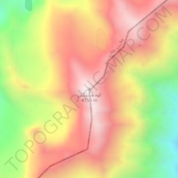
Name: Koh-e Hindukush topographic map, elevation, terrain.
Location: Koh-e Hindukush, Khinjan, Baghlan Province, Afghanistan (35.40055 69.15903 35.40065 69.15913)
Average elevation: 3,747 m
Minimum elevation: 3,161 m
Maximum elevation: 4,178 m
Thank you for supporting this site ❤️
Make a donation
Make a donation
Gear up for your next adventure:
As an Amazon Associate, this site earns from qualifying purchases at no extra cost to you.