
Sidoarjo topographic map
Interactive map
Click on the map to display elevation.
About this map
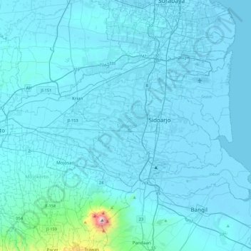
Name: Sidoarjo topographic map, elevation, terrain.
Location: Sidoarjo, East Java, Indonesia (-7.58224 112.45669 -7.33027 112.88184)
Average elevation: 60 m
Minimum elevation: -3 m
Maximum elevation: 1,616 m
Other topographic maps
Click on a map to view its topography, its elevation and its terrain.