
La Mandria topographic map
Interactive map
Click on the map to display elevation.
About this map
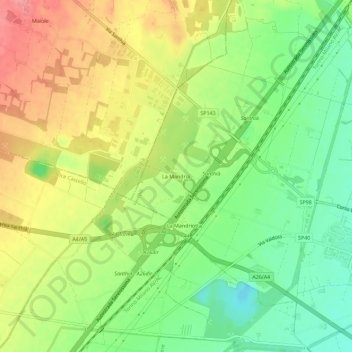
Name: La Mandria topographic map, elevation, terrain.
Location: La Mandria, Santhià, Vercelli, Piedmont, 13048, Italy (45.35877 8.11012 45.39877 8.15012)
Average elevation: 214 m
Minimum elevation: 177 m
Maximum elevation: 254 m