
Thank you for supporting this site ❤️
Make a donation
Make a donation
Gear up for your next adventure:
As an Amazon Associate, this site earns from qualifying purchases at no extra cost to you.
Lecina topographic map
Click on the map to display elevation.
Thank you for supporting this site ❤️
Make a donation
Make a donation
Gear up for your next adventure:
As an Amazon Associate, this site earns from qualifying purchases at no extra cost to you.
About this map
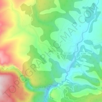
Name: Lecina topographic map, elevation, terrain.
Location: Lecina, Bárcabo, Sobrarbe, Huesca, Aragon, 22148, Spain (42.20979 0.01500 42.24979 0.05500)
Average elevation: 805 m
Minimum elevation: 632 m
Maximum elevation: 1,120 m
Thank you for supporting this site ❤️
Make a donation
Make a donation
Gear up for your next adventure:
As an Amazon Associate, this site earns from qualifying purchases at no extra cost to you.