
Thank you for supporting this site ❤️
Make a donation
Make a donation
Gear up for your next adventure:
As an Amazon Associate, this site earns from qualifying purchases at no extra cost to you.
Uchuy topographic map
Click on the map to display elevation.
Thank you for supporting this site ❤️
Make a donation
Make a donation
Gear up for your next adventure:
As an Amazon Associate, this site earns from qualifying purchases at no extra cost to you.
About this map
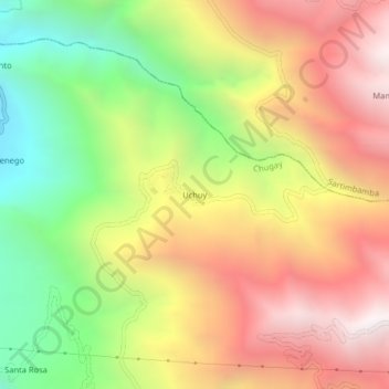
Name: Uchuy topographic map, elevation, terrain.
Location: Uchuy, Chugay, Sánchez Carrión, La Libertad, Perú (-7.67441 -77.83902 -7.63441 -77.79902)
Average elevation: 2,676 m
Minimum elevation: 1,799 m
Maximum elevation: 3,512 m
Thank you for supporting this site ❤️
Make a donation
Make a donation
Gear up for your next adventure:
As an Amazon Associate, this site earns from qualifying purchases at no extra cost to you.