
Thank you for supporting this site ❤️
Make a donation
Make a donation
Gear up for your next adventure:
As an Amazon Associate, this site earns from qualifying purchases at no extra cost to you.
Chepen topographic map
Click on the map to display elevation.
Thank you for supporting this site ❤️
Make a donation
Make a donation
Gear up for your next adventure:
As an Amazon Associate, this site earns from qualifying purchases at no extra cost to you.
About this map
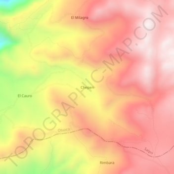
Name: Chepen topographic map, elevation, terrain.
Location: Chepen, Salpo, Province of Otuzco, La Libertad, Peru (-8.10160 -78.67129 -8.06160 -78.63129)
Average elevation: 3,481 m
Minimum elevation: 2,927 m
Maximum elevation: 3,769 m
Thank you for supporting this site ❤️
Make a donation
Make a donation
Gear up for your next adventure:
As an Amazon Associate, this site earns from qualifying purchases at no extra cost to you.