
Thank you for supporting this site ❤️
Make a donation
Make a donation
Gear up for your next adventure:
As an Amazon Associate, this site earns from qualifying purchases at no extra cost to you.
Arbroath topographic map
Click on the map to display elevation.
Thank you for supporting this site ❤️
Make a donation
Make a donation
Gear up for your next adventure:
As an Amazon Associate, this site earns from qualifying purchases at no extra cost to you.
About this map
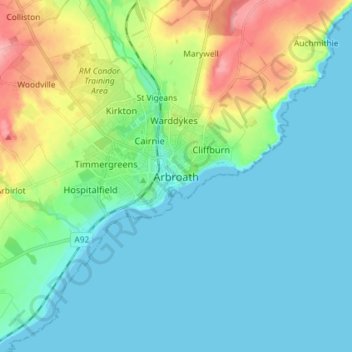
Name: Arbroath topographic map, elevation, terrain.
Location: Arbroath, Angus, Scotland, DD11 1DP, United Kingdom (56.51867 -2.62157 56.59867 -2.54157)
Average elevation: 24 m
Minimum elevation: 0 m
Maximum elevation: 98 m
Thank you for supporting this site ❤️
Make a donation
Make a donation
Gear up for your next adventure:
As an Amazon Associate, this site earns from qualifying purchases at no extra cost to you.