
Thank you for supporting this site ❤️
Make a donation
Make a donation
Gear up for your next adventure:
As an Amazon Associate, this site earns from qualifying purchases at no extra cost to you.
Kito-kiganda topographic map
Click on the map to display elevation.
Thank you for supporting this site ❤️
Make a donation
Make a donation
Gear up for your next adventure:
As an Amazon Associate, this site earns from qualifying purchases at no extra cost to you.
About this map
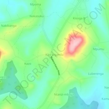
Name: Kito-kiganda topographic map, elevation, terrain.
Location: Kito-kiganda, Mukono, Central Region, Uganda (0.21152 32.78699 0.25152 32.82699)
Average elevation: 1,203 m
Minimum elevation: 1,151 m
Maximum elevation: 1,327 m
Thank you for supporting this site ❤️
Make a donation
Make a donation
Gear up for your next adventure:
As an Amazon Associate, this site earns from qualifying purchases at no extra cost to you.