Geolocate

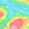
Ryton topographic map

Click on the map to display elevation.

About this map

Name: Ryton topographic map, elevation, terrain.

Location: Ryton, Gateshead, Tyne and Wear, North East, England, United Kingdom (54.96586 -1.78249 54.97871 -1.74462)

Average elevation: 59 m

Minimum elevation: -2 m

Maximum elevation: 134 m

Other topographic maps

Click on a map to view its topography, its elevation and its terrain.

Gateshead

United Kingdom > England > Tyne and Wear > Gateshead

One of the most distinguishing features of Gateshead is its topography. The land rises 230 feet (70 m) from Gateshead Quays to the town centre and continues rising to a height of 525 feet (160 m) at Queen Elizabeth Hospital in Sheriff Hill. This is in contrast to the flat and low lying Team Valley located on…

Average elevation: 62 m

Whickham

United Kingdom > England > Tyne and Wear > Gateshead

Average elevation: 77 m

Swalwell

United Kingdom > England > Tyne and Wear > Gateshead

Average elevation: 52 m

Birtley

United Kingdom > England > Tyne and Wear > Gateshead

Average elevation: 68 m

Swalwell

United Kingdom > England > Tyne and Wear > Gateshead

Average elevation: 52 m

Gear up for your next adventure:

🩰Hiking Binoculars - See long distances on trails
🏃Men's Trail Runners - Grip and speed for rugged Irish mountain running
🌦️Weatherproof Outdoor Gear - Protection from unpredictable weather
🧶Camping String Lights - Ambience and utility lighting
🦺Outdoor Safety Vests - Increase visibility and safety

As an Amazon Associate, this site earns from qualifying purchases at no extra cost to you.