Geolocate

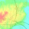
Burlington topographic map

Click on the map to display elevation.

About this map

Name: Burlington topographic map, elevation, terrain.

Location: Burlington, Milam County, Texas, United States (30.99489 -97.01691 31.03489 -96.97691)

Average elevation: 132 m

Minimum elevation: 118 m

Maximum elevation: 147 m

Other topographic maps

Click on a map to view its topography, its elevation and its terrain.
Rockdale

United States > Texas > Milam County

Average elevation: 147 m

Thorndale

United States > Texas > Milam County

Average elevation: 135 m

Cameron

United States > Texas > Milam County

Average elevation: 116 m

Cameron

United States > Texas > Milam County

Average elevation: 116 m

Milano

United States > Texas > Milam County

Average elevation: 149 m

Gear up for your next adventure:

🧥Waterproof Hiking Jackets - Rain jackets for unpredictable weather
🧤Thermal Outdoor Gloves - Windproof and waterproof gloves for winter hiking
🔋Portable Power Banks - Keep devices charged on long trips
🌿Irish Flora Guides - Identify plants while exploring the countryside
🧭Route Planning Books - Plan the best hiking routes

As an Amazon Associate, this site earns from qualifying purchases at no extra cost to you.