Geolocate

Pomeroy topographic map

Click on the map to display elevation.

About this map

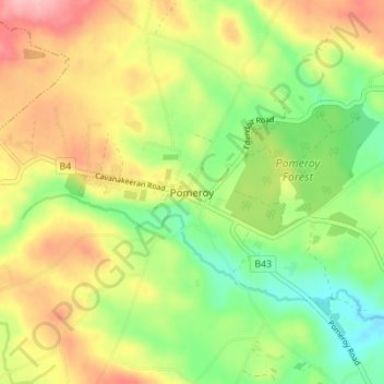
Name: Pomeroy topographic map, elevation, terrain.

Location: Pomeroy, County Tyrone, Northern Ireland, United Kingdom (54.57405 -6.94595 54.61405 -6.90595)

Average elevation: 169 m

Minimum elevation: 106 m

Maximum elevation: 243 m

Gear up for your next adventure:

Smart Watches for Hiking - Track performance on trails
🔦Everyday Carry Torches - Reliable backup light for your hiking pack
💺Camping Hammocks - Relax afloat camp setup
🧯Campfire Safety Gear - Gear to safely manage fires
🔌Fast Car Chargers - Recharge GPS and phones between trailheads

As an Amazon Associate, this site earns from qualifying purchases at no extra cost to you.