
Thank you for supporting this site ❤️
Make a donation
Make a donation
Gear up for your next adventure:
As an Amazon Associate, this site earns from qualifying purchases at no extra cost to you.
Gleneagle topographic map
Click on the map to display elevation.
Thank you for supporting this site ❤️
Make a donation
Make a donation
Gear up for your next adventure:
As an Amazon Associate, this site earns from qualifying purchases at no extra cost to you.
About this map
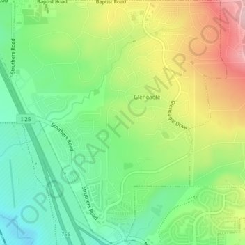
Name: Gleneagle topographic map, elevation, terrain.
Location: Gleneagle, El Paso County, Colorado, United States (39.02771 -104.84741 39.05668 -104.81225)
Average elevation: 2,099 m
Minimum elevation: 2,015 m
Maximum elevation: 2,225 m
Thank you for supporting this site ❤️
Make a donation
Make a donation
Gear up for your next adventure:
As an Amazon Associate, this site earns from qualifying purchases at no extra cost to you.