Geolocate

Epping topographic map

Click on the map to display elevation.

About this map

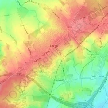
Name: Epping topographic map, elevation, terrain.

Location: Epping, Epping Forest, Essex, England, United Kingdom (51.67947 0.08993 51.71195 0.14001)

Average elevation: 84 m

Minimum elevation: 35 m

Maximum elevation: 117 m

Other topographic maps

Click on a map to view its topography, its elevation and its terrain.

Gear up for your next adventure:

🧦Merino Wool Socks - Moisture-wicking and blister-preventing trail socks
📍Trail Markers & GPS - Tools to track and mark trails
🦯Lightweight Trekking Poles - Reduce knee strain on steep Wicklow or Kerry slopes
📡Satellite Messengers - Emergency messaging when off‑grid
🧴Long-Lasting Sunscreen - Protect against UV rays during long days on the ridges

As an Amazon Associate, this site earns from qualifying purchases at no extra cost to you.