
Thank you for supporting this site ❤️
Make a donation
Make a donation
Gear up for your next adventure:
As an Amazon Associate, this site earns from qualifying purchases at no extra cost to you.
Amatitán topographic map
Click on the map to display elevation.
Thank you for supporting this site ❤️
Make a donation
Make a donation
Gear up for your next adventure:
As an Amazon Associate, this site earns from qualifying purchases at no extra cost to you.
About this map
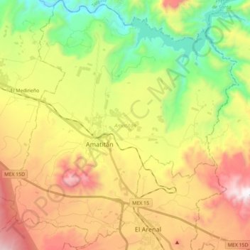
Name: Amatitán topographic map, elevation, terrain.
Location: Amatitán, Region Valles, Jalisco, 45380, Mexico (20.76330 -103.79039 20.92582 -103.63166)
Average elevation: 1,242 m
Minimum elevation: 619 m
Maximum elevation: 2,019 m
Thank you for supporting this site ❤️
Make a donation
Make a donation
Gear up for your next adventure:
As an Amazon Associate, this site earns from qualifying purchases at no extra cost to you.