
Thank you for supporting this site ❤️
Make a donation
Make a donation
Gear up for your next adventure:
As an Amazon Associate, this site earns from qualifying purchases at no extra cost to you.
Liaodong topographic map
Click on the map to display elevation.
Thank you for supporting this site ❤️
Make a donation
Make a donation
Gear up for your next adventure:
As an Amazon Associate, this site earns from qualifying purchases at no extra cost to you.
About this map
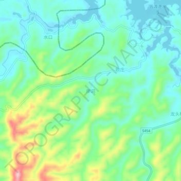
Name: Liaodong topographic map, elevation, terrain.
Location: Liaodong, Xinfeng County, Ganzhou, Jiangxi, China (25.20526 114.72098 25.24526 114.76098)
Average elevation: 243 m
Minimum elevation: 187 m
Maximum elevation: 382 m
Thank you for supporting this site ❤️
Make a donation
Make a donation
Gear up for your next adventure:
As an Amazon Associate, this site earns from qualifying purchases at no extra cost to you.