
Thank you for supporting this site ❤️
Make a donation
Make a donation
Gear up for your next adventure:
As an Amazon Associate, this site earns from qualifying purchases at no extra cost to you.
Noiraigue topographic map
Click on the map to display elevation.
Thank you for supporting this site ❤️
Make a donation
Make a donation
Gear up for your next adventure:
As an Amazon Associate, this site earns from qualifying purchases at no extra cost to you.
About this map
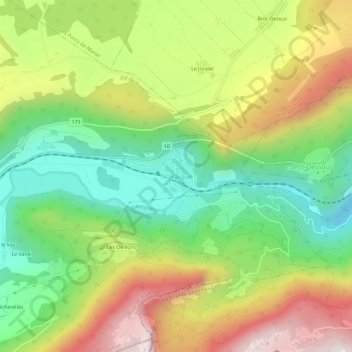
Name: Noiraigue topographic map, elevation, terrain.
Location: Noiraigue, Val-de-Travers, Neuchâtel, 2103, Switzerland (46.93455 6.70493 46.97455 6.74493)
Average elevation: 981 m
Minimum elevation: 639 m
Maximum elevation: 1,434 m
Thank you for supporting this site ❤️
Make a donation
Make a donation
Gear up for your next adventure:
As an Amazon Associate, this site earns from qualifying purchases at no extra cost to you.