Geolocate

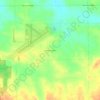
Winslow topographic map

Click on the map to display elevation.

About this map

Name: Winslow topographic map, elevation, terrain.

Location: Winslow, Stephenson County, Illinois, United States (42.48629 -89.80275 42.50125 -89.78950)

Average elevation: 247 m

Minimum elevation: 232 m

Maximum elevation: 276 m

Other topographic maps

Click on a map to view its topography, its elevation and its terrain.
Gear up for your next adventure:

🥄Titanium Sporks - Indestructible and ultralight eating utensil
☕Vacuum Insulated Flasks - Keep tea or coffee hot for 12 hours on the summit
🥽UV Protection Sunglasses - Protect eyes on bright days
🎒Backpack Rain Covers - Extra protection for non-waterproof rucksacks
📦Outdoor Storage Bags - Keep gear organized and dry

As an Amazon Associate, this site earns from qualifying purchases at no extra cost to you.