
Thank you for supporting this site ❤️
Make a donation
Make a donation
Gear up for your next adventure:
As an Amazon Associate, this site earns from qualifying purchases at no extra cost to you.
Adliswil topographic map
Click on the map to display elevation.
Thank you for supporting this site ❤️
Make a donation
Make a donation
Gear up for your next adventure:
As an Amazon Associate, this site earns from qualifying purchases at no extra cost to you.
About this map
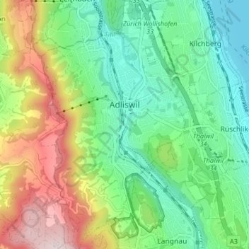
Name: Adliswil topographic map, elevation, terrain.
Location: Adliswil, Bezirk Horgen, Zurich, 8134, Switzerland (47.28627 8.50318 47.33018 8.54076)
Average elevation: 567 m
Minimum elevation: 400 m
Maximum elevation: 887 m
Thank you for supporting this site ❤️
Make a donation
Make a donation
Gear up for your next adventure:
As an Amazon Associate, this site earns from qualifying purchases at no extra cost to you.