
Blackburn topographic map
Interactive map
Click on the map to display elevation.
About this map
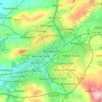
Name: Blackburn topographic map, elevation, terrain.
Average elevation: 157 m
Minimum elevation: 77 m
Maximum elevation: 314 m
Other topographic maps
Click on a map to view its topography, its elevation and its terrain.
Darwen
Royaume-Uni > Angleterre > Blackburn with Darwen
Darwen, Blackburn with Darwen, Angleterre, Royaume-Uni
Average elevation: 259 m