Geolocate

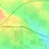
Krum topographic map

Click on the map to display elevation.

About this map
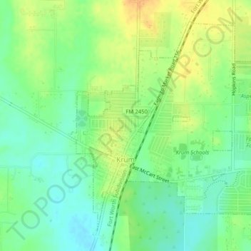
Name: Krum topographic map, elevation, terrain.

Location: Krum, Denton County, Texas, United States (33.25255 -97.24617 33.27991 -97.20698)

Average elevation: 219 m

Minimum elevation: 204 m

Maximum elevation: 238 m

Other topographic maps

Click on a map to view its topography, its elevation and its terrain.

Union Hill

United States > Texas > Denton County

Average elevation: 200 m

Memorial Park

United States > Texas > Denton County > Lewisville

Average elevation: 166 m

Fort Worth

United States > Texas > Denton County

Average elevation: 213 m

Hills of Roanoke

United States > Texas > Denton County > Roanoke

Average elevation: 180 m

Mustang

United States > Texas > Denton County

Average elevation: 182 m

Parvin

United States > Texas > Denton County > Prosper

Average elevation: 180 m

Stony

United States > Texas > Denton County

Average elevation: 240 m

Gear up for your next adventure:

📷Compact Binoculars - High-definition optics for scouting terrain and wildlife
🧗Climbing Gear - Essential equipment for climbing routes
🔦Everyday Carry Torches - Reliable backup light for your hiking pack
🥾Mountaineering Boots - Heavy‑duty boots for rugged peaks
🍁Eco‑Friendly Outdoor Products - Sustainable outdoor gear

As an Amazon Associate, this site earns from qualifying purchases at no extra cost to you.