
Thank you for supporting this site ❤️
Make a donation
Make a donation
Gear up for your next adventure:
As an Amazon Associate, this site earns from qualifying purchases at no extra cost to you.
Patalganga topographic map
Click on the map to display elevation.
Thank you for supporting this site ❤️
Make a donation
Make a donation
Gear up for your next adventure:
As an Amazon Associate, this site earns from qualifying purchases at no extra cost to you.
About this map
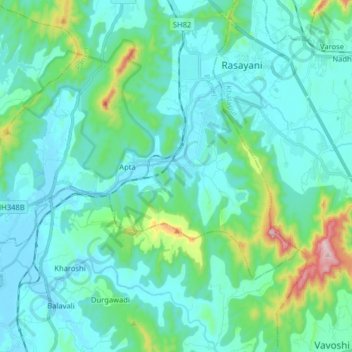
Name: Patalganga topographic map, elevation, terrain.
Location: Patalganga, Apta, Panvel, Raigad, Maharashtra, India (18.80980 73.07157 18.89020 73.23129)
Average elevation: 85 m
Minimum elevation: -1 m
Maximum elevation: 543 m
Thank you for supporting this site ❤️
Make a donation
Make a donation
Gear up for your next adventure:
As an Amazon Associate, this site earns from qualifying purchases at no extra cost to you.